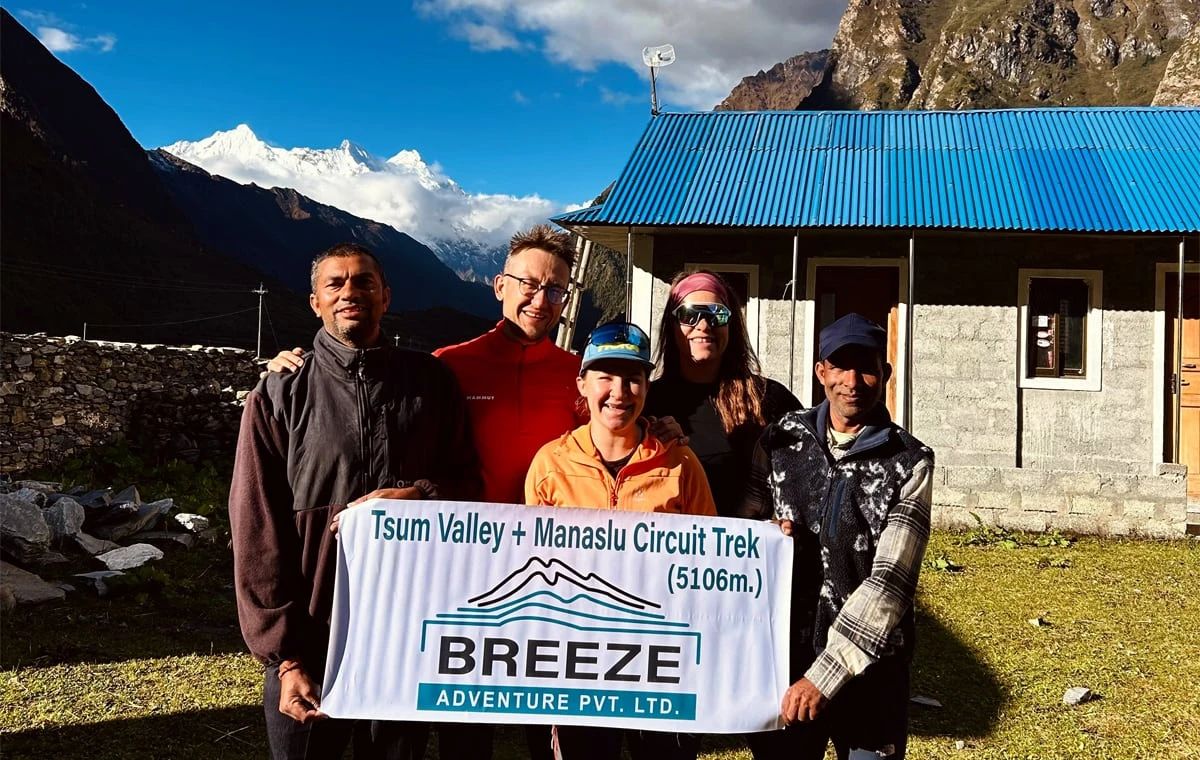
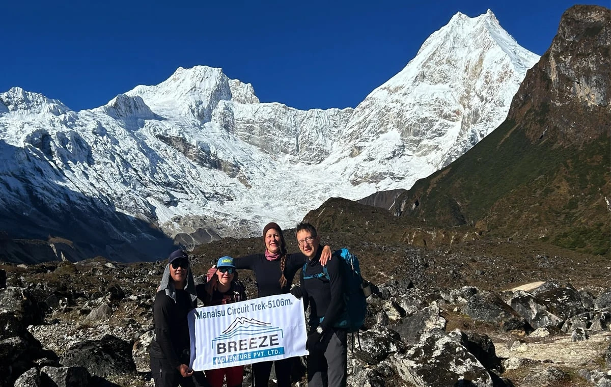
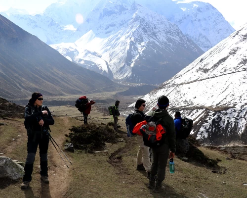
Manaslu Tsum Valley Trek - 23 Days

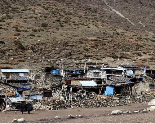
Tsum Valley Village
At a Glance
  • Duration23 Days
  • Difficulty Level Moderate
  • Max Altitude 5120m
  • Group Size 2 - 20 Person
  • Start City Kathmandu City
  • End City Kathmandu City
  • Trip Type Private and Group Joining
  • Activity Trekking and Hiking
  • Best Season March - May and September - November
Trip Highlights
  • Personal experience with the residents of Tsum Valley that goes above and beyond the interactions on a more popular trekking route.
  • Larkya La Pass (5135 meters) – a panoramic view of mountains as far as the eye can see
  • A trail that is vastly underrated and unpopulated, providing a more peaceful journey
  • Tsum Valley is a paradise! Full of cascading waterfalls, snowy peaks, and welcoming villagers
  • Majestic mountain vistas, including SringiHimal (7165m), Hiunchuli (6441m), and Ganesh Himal (7422m).
  • A variety of landscapes – from subtropical jungle to the rugged high alpine environment

Our Manaslu Tsum Valley Trek is a wonderful combination of two treks: The Manaslu Circuit Trek and Tsum Valley Trek. Neither of these trails is heavily trafficked, and in fact, they are two of the more underrated treks in the country. The combination makes for a 23-day excursion into the precious Hidden Valley of Tsum and around the pristine Manaslu(8,156 meters/26,758 feet) – the 8th tallest mountain in the world.

This journey has it all – terraced hillsides, raging rivers, mountain settlements, alpine passes, and of course, huge snow-clad mountains. If you look at a map of the ManasluTsum Valley Trek, you will see that the trail is nestled between two popular trekking spots: the Annapurna Conservation Area and Langtang National Park. However, this trail, particularly Tsum Valley, has a unique, almost untouched feel to it.

Overview of the Tsum Valley Trek

The trek begins in Tsum Valley with a head up from SotiKhola, following the turquoise Budi Gandaki River northward. The cool breeze makes us feel at peace, though inside we are so excited for each day to come. From Jagat, we enter Tsum Valley, and we are already surrounded by mountains. Upon arrival there, trekkers feel as if they have entered a truly Hidden Valley, existing outside of time. During our time in the valley, we will stay with the Tsum people, who practice Tibetan Buddhism. Admire their mani stones, wavering prayer flags, and ornate monasteries. Following the Shyar River, we leave the fertile valley to get an up-close view of the mountains at Mu Monastery. The Tsum Valley is a magical place, teeming with spiritual energy. 

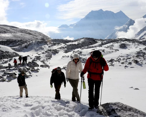
Then, we begin the Manaslu Circuit part of the trail. A major highlight of this section is traversing the Larkya La Pass (5135 meters), which exposes trekkers to mind-boggling mountain views. We are eye-to-eye with these massive peaks, which make us feel humbled to be in their presence. Two days after the pass, we arrive in Dharapani, take a two-hour drive to Besisahar, and stay for the night.  The following day we bid farewell, or rather “see you later” to the mountain, and will return to Kathmandu.

Throughout the trek, we are surrounded by peaks, including SringiHimal (7165m), Hiunchuli (6441m), Ganesh Himal (7422m), and of course Manaslu (8156m). Additionally, there’s plenty of wildlife to admire, including the musk deer, snow leopard, red panda, and much more. The sceneries throughout the ManasluTsum Valley Trek are the kind that inspire religions. Don’t forget to look up from your feet and set your gaze upon the beautiful environment surrounding you.

Best Time for Manaslu Tsum Valley Trek

Trekking is possible throughout the year, but Spring (March to May) and Autumn (September to November) provide the best weather.  During the Spring, there is a bit more color and the rhododendrons are blooming, and in the Autumn months, the skies are generally clearer. Whatever you plan just make sure you don't end up on a high mountain trek in the monsoon. That’s quite a bad idea. Saying that Spring and Autumn are undoubtedly the best times for the Manaslu Tsum Valley trek

Permit requirements

Following Laws and orders are always good so meeting the permit requirements for your Manaslu Tsum Valley Trek becomes necessary. You must have three obliged permits for this trek; the Manaslu Restricted Area Permit (RAP) and the Manaslu Conservation Area Project (MCAP) Permit for exploring and maintaining the Manaslu area,  and the Tsum Valley Restricted Area Permit (RAP) for getting into the main destination for this trip. Besides, the trek also crosses the Annapurna Circuit Trek region so the Annapurna Conservation Area Project (ACAP) Permit might also be crucial. For less pressure, book your trip with a trusted travel agency that will take care of these permits for you.

Why Manaslu Tsum Valley Trek?

Being an underrated trial in Nepal, the Manaslu Tsum Valley trek is a perfect option for those who prefer a calm journey away from chaos. It is a less crowded hike destination in the Manaslu region that allows you to get up close to the natural and cultural beauty of the area. Additionally, the more sacred and remote settlements of Tsum Valley will make you realize that life is not always roses but also thorns sometimes. You could take this opportunity to enjoy a new and unique perspective on life and just enjoy yourself in the moment. Trust me, the view and the traditional encounters will not disappoint you throughout your Tsum Valley journey.

If you are looking for something less long than the Tsum Valley trek in Manaslu region, you can consider a quick Masanslu Circuit Trek.

Route Navigation

Navigating routes for this trek might be a bit difficult due to its unexplored pathways but with a local guide and brief knowledge about the area, you can do it. Your journey begins at Soti Khola and then gradually moves upwards to more nature and beauty. The trail takes you through the Tsum Valley, visiting ancient monasteries and traditional Tibetan villages, before looping around Mount Manaslu. For a better and safer trip, hire a local and experienced guide who has in-depth knowledge about the trial and the region. Furthermore, you could also have a Tsum Valley Map with you to keep up with the routes. But, don’t stress yourself out, just trust your guide and enjoy the trek.

Cultural Immersion in Tsum Valley

Exploring Tsum Valley provides an immersive cultural experience that enriches the Manaslu Tsum Valley Trek. You will see old monasteries scattered across the terrain and observe traditional Tibetan Buddhist practices as you travel through this magnificent region. The local villages uphold generations-old lifestyles and are renowned for their authentic warmth and hospitality. You will be able to engage with people in small villages and learn about their religious practices, traditional farming methods, and colorful celebrations. A significant and unforgettable addition to your trekking adventure is an in-depth exploration of the rich cultural life of the area.

Packing List for the Manaslu Tsum Valley Trek: Essential Gear and Clothing

When preparing for the Manaslu Tsum Valley Trek, having the right gear and clothing is crucial for a safe and comfortable experience. Here’s a packing list to ensure you’re well-prepared:

Clothing:

  • Base Layers: Moisture-wicking thermal tops and bottoms.

  • Insulating Layers: Fleece or down jacket for warmth.

  • Outer Layers: Waterproof and windproof jacket and pants.

  • Trekking Pants: Lightweight and quick-drying.

  • Warm Hat, Gloves, and Scarf: Essential for colder temperatures.

  • Sun Protection: Hat, sunglasses, and UV-protection clothing.

Footwear:

  • Trekking Boots: Waterproof and well-fitted with good ankle support.

  • Camp Shoes: Lightweight sandals or sneakers.

Gear:

  • Backpack: 40-50 liter with a rain cover.

  • Sleeping Bag: Rated for cold temperatures.

  • Trekking Poles: Helpful for stability on uneven terrain.

  • Headlamp: With extra batteries.

Other Essentials:

  • Water Bottle or Hydration System: Keep hydrated on the trail.

  • First Aid Kit: Include altitude sickness medication and personal essentials.

  • Sunscreen and Lip Balm: High SPF for sun protection.

  • Personal Hygiene Items: Biodegradable soap, hand sanitizer, and toilet paper.

Documents:

  • Permits: Manaslu RAP, Tsum Valley RAP, MCAP, and ACAP.

  • Passport and Copies: Important for identification and permits.

Itinerary

Expand all Collapse all

Welcome to Nepal! A representative from Breeze Adventure will welcome you our hotel.  We will prepare you with information and gear for your trek.

  • Max Altitude: 1400m
  • Accommodation: 2/3 Star Hotel
  • Meals: Breakfast

Have breakfast and start sightseeing around Kathmandu in a private vehicle.  We will see several UNESCO World Heritage Sites.  We will learn about each site’s historical, religious, and cultural significance.

  • Max Altitude: 1400m
  • Accommodation: 2/3 Star Hotel
  • Meals: Breakfast

We set off early today to Machhakhola. During the drive, we have views of the countryside, with glimpses into the locals’ lifestyle and surrounding mountain sceneries. We drive on a smooth road from Kathmandu to DhadingBesi, the district headquarters of Dhading (1050m) but the drive from DhadingBesi to Arughat will be on a rough road.  Upon reaching Arughat, a major town in the region, we drive further towards Machhakhola.

  • Max Altitude: 590m
  • Accommodation: Tea House
  • Time: 9 Hours
  • Meals: BLD
  • Transport: Jeep/Bus

Our narrow trail makes a few small ups and downs and eventually traverses over the TharoKhola to reach Khorlabesi. After a few more ups and downs, we come across a small natural hot spring in Tatopani. From the hot spring, we move over another ridge and cross the Budhi Gandaki on a suspension bridge. At this juncture, we climb on a wide, well-crafted staircase, then across a landslide and over a ridge to Doban. After we cross the suspension bridge over the YaruKhola, we climb the stone stairs and descend to the river. We again climb more stone stairs to TharoBharyang. Crossing the west bank of the Budhi Gandaki, we climb over another ridge and walk along the river to eventually reach the village of Jagat.

  • Max Altitude: 1370m
  • Time: 6 Hours
  • Walking Distance: 16km

Today we check into the restricted region of Manaslu and Tsum Valley. The guide will register the permits when leaving. In the beginning, we trek a bit along the riverbank. During some ups and downs, Philim comes into our sight. We cross a suspension bridge and stop in Philim for lunch. Briefly explore the village of Philim and its school funded by the Japanese. PassingEkle Bhatti, the trail separates toward Tsum and Manaslu. Pass through the welcome board and hike up toward Lokpa. You might feel like it is early to stop in Lokpa but the next settlement Chumling is too far to make in one day.

  • Max Altitude: 2240m
  • Accommodation: Teahouse
  • Time: 6 Hours
  • Meals: BLD
  • Walking Distance: 15km

For the whole stretch today, there is nowhere to stop, so we pack extra snacks. The trail completely passes through a quiet, sub-tropical forest. You will encounter numerous ups and downs until you arrive small suspension bridge. The trail then gets diverted from this bridge toward Ripchet and Chumling. Cross the bridge and walk by a small stone wall on the side of the trail. Chumling is not that far from this point. There are a few teahouses by the main trail. In the late afternoon, you can make a small side trip to the upper part of Chumling, there are a few teahouses too. There is a monastery at the upper end of the village which has an awesome view of Ganesh Himal.

  • Max Altitude: 2386m
  • Accommodation: Teahouse
  • Time: 6 Hours
  • Meals: BLD
  • Walking Distance: 15km

Cross the suspension bridge onto the opposite side of the river, and enjoy another spectacular view of Ganesh Himal. Walk past Rainjham to Selpukhola, at which point we enter the hidden valley of Tsum. Another steep climb takes us to the village of Chhokang Paro, today’s destination. Admire the magnificent Hiunchuli at 7893 meters.

  • Max Altitude: 3030m
  • Accommodation: Teahouse
  • Time: 7 Hours
  • Meals: BLD
  • Walking Distance: 18km

There are lots of mani walls, gompas, and Chhortens as we make our way further up the Tsum Valley, nearing the border of Tibet. We can stop for some tea from the friendly nuns at RachenGompa. We stop for lunch in either Chhile or Nile, and stay at one or the other for the night. Chhule boasts two dramatic waterfalls high above us. On a clear day, we can see the Churke and KipuHimal.  Spend the rest of the day hanging out in the lodge or exploring the beautiful scenery.

  • Max Altitude: 3360m
  • Accommodation: Teahouse
  • Time: 6 Hours
  • Meals: BLD
  • Walking Distance: 16km

After breakfast, the trail gradually ascends to Mu Gumba, the largest monastery in the region and the farthest point in the Tsum Valley. We can take a tour of it, as our itinerary is short today. Chhosyang Tal is about two to three hours uphill walk, and then we visit DephyudonmaGumba, one of the oldest monasteries in the Tsum Valley. The monastery is nestled high in the mountains, a most picturesque location. It is run by Lama Serap of Nile Ladrang from the Kangin sect. There are a few campsites and drinking water facilities. Overnight in a guest house.

  • Max Altitude: 3700m
  • Accommodation: Teahouse
  • Time: 4 Hours
  • Meals: BLD
  • Walking Distance: 9km

We begin our hike after breakfast. It’s a long day full of gorgeous views back to Chokang Paro. The numerous mani walls, Chhortens, and prayer flags wavering in the wind give us a sense of peace throughout the day.  We can stop again at RachenGompa, the large monastery/nunnery in the area, for a mid-day break. Overnight in the guest house.

  • Max Altitude: 3030m
  • Accommodation: Teahouse
  • Time: 7 Hours
  • Meals: BLD
  • Walking Distance: 19km

Today, we retrace our steps back down the Tsum Valley. The trail entails lots of ups and downs, stretching along the bank of the SardiKhola and lifting back up to terraced fields and suspension bridges. We can stop for a rest in villages along the way, or make a visit to a gompa. We enjoyed our second time in Chumling, spending time with the locals and having a nice dal bhat for dinner.

  • Max Altitude: 2386m
  • Accommodation: Teahouse
  • Time: 5 Hours
  • Meals: BLD
  • Walking Distance: 14km

We head out after our morning meal towards Deng. Our first stop is in Gho, where there is a small gompa. We then steer ourselves over the SiyarKhola via a wooden bridge and wind up in Domje. The trail then leads back to Lokpa, which we’ve already passed through earlier on in the trek. Continuing, we divert from this trail before reaching Philim, and take the trail up to Deng.

  • Max Altitude: 1920m
  • Accommodation: Teahouse
  • Time: 6 Hours
  • Meals: BLD
  • Walking Distance: 15km

After leaving Deng, we cross the BudhiGandaki again and ascend to Rana (1910m). We go up a bit more to take the trail from Bhi, then head west up the Budhi Gandaki valley. The trail passes through mixed forests. We take the route that goes through the village, which has a perfect viewpoint for SiringiHimal. We cross the Budi Gandaki several times today and come across several gompas as well, which we can stop for a visit. The trail follows the river upstream through a dense forest. The forest becomes less dense and the trail is level again. The pleasant walk continues and after one last steep incline, we reach Namrung.

  • Max Altitude: 2250m
  • Accommodation: Teahouse
  • Time: 7 Hours
  • Meals: BLD
  • Walking Distance: 17km

Right when you leave your bed, you have awesome views of Siring and Ganesh Himal, and from the village, you can also see Hiunchulito in the south. We climb steadily, passing through forests to reach Lihi, a fine village with many Chhortens and barley field terraces. The trail drops and crosses the side valley of Simnang Himal with Ganesh Himalin's eyeshot. We pass through the Sho, Lho, and Shyala villages before reaching Sama. We enjoy extraordinary views of Manaslu from Lho, where we can also explore the famous Ribung Gompa. In Shyala, we find ourselves encompassed by high peaks like Hiunchuli and Peak 29 (NgadiChuli) to the left, with Manaslu and large glaciers straight ahead, and at the far end stands Ganesh Himal. Today’s journey ends in Samagaon.

  • Max Altitude: 3450m
  • Accommodation: Tea House
  • Time: 6 Hours
  • Meals: BLD
  • Walking Distance: 16km

Today, we take it easy and let our bodies become accustomed to the altitude.  If you have any interest, we can do a day hike and explore the surrounding area. 

  • Max Altitude: 3550m
  • Accommodation: Tea House
  • Time: 1 Hour
  • Meals: BLD
  • Walking Distance: 2km

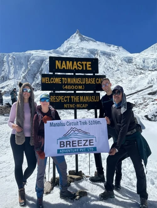
Today, we descend to the BudhiGandaki River, which has turned north, and follow it to a bridge over a side stream. The trail to the left leads to Manaslu Base Camp. The Larke La Trail passes several mani walls as the valley widens. It is an easy trail above the river passing juniper and birch forests of KermoKharka. We drop down, cross the Budhi Gandaki on a wooden bridge, and climb steeply. From a stone arch, we can view a large white kani. Finally passing through the kani, we find Samdo.

  • Max Altitude: 3780m
  • Accommodation: Tea House
  • Time: 4 Hours
  • Meals: BLD
  • Walking Distance: 7km

Soon after heading out on the trail, we cross the wooden bridge over the Budi Gandaki and walk on and upward. After crossing two streams and witnessing the Larkya Glacier we go around the valley of the SalkaKhola and climb up again to the stone guest house (4460m), which is not a lodge but rather a shelter called Dharmshala, also known as LarkePhedi. The short walk today also leaves plenty of time for acclimatization and hanging out in the afternoon.

  • Max Altitude: 4460m
  • Accommodation: Teahouse
  • Time: 4 Hours
  • Meals: BLD
  • Walking Distance: 9km

After a short climb, we reach a valley on the north side of the Larkya Glaciers from where we can enjoy great views of Cho Danda and Larke Peak. Finally, we walk across the moraines of the glacier, making a gradual ascent which becomes steeper in the last section of the pass. In the past, there were outstanding views of HimlungHimal, CheoHimal, Kangguru, and the massive Annapurna II. It is a longer day than usual to Bimtang, but to walk into these low pastures with the evening mist coming in and face-to-face views of Manaslu is an exciting experience.

  • Max Altitude: 3630m
  • Accommodation: Teahouse
  • Time: 7 Hours
  • Meals: BLD
  • Walking Distance: 19km

Surki is our stopover for lunch today. We therefore head off in this direction. On narrow paths mostly, we reach Surki, a small settlement, in about four hours. This is where we stop for lunch in one of those five or six service providers. It takes a couple of more hours for us to reach Tilje from here on. Although Tilje is a small settlement, it provides us with many places to options for our accommodation.

  • Max Altitude: 2240m
  • Accommodation: Teahouse
  • Time: 6 Hours
  • Meals: BLD
  • Walking Distance: 17km

Today, we start out on a long, but easy descent. We stopped at Dharapani on the way for lunch. Lunch is over and we continue. Crossing into the Annapurna Conservation Area requires us to produce one more permit. Soon, we make it to Besisahar after a scenic drive. 

  • Max Altitude: 770
  • Accommodation: Hotel
  • Time: 4 Hours
  • Meals: BLD
  • Walking Distance: 6km
  • Transport: Jeep

Transfer to Tribhuvan Airport.  Thank you for choosing Breeze Adventure as your trekking guide!  We look forward to your next adventure with us.

  • Max Altitude: 1400m
  • Accommodation: 2/3 Star Hotel
  • Meals: BLD

Transfer to Tribhuvan Airport.  Thank you for choosing Breeze Adventure as your trekking guide!  We look forward to your next adventure with us.

  • Meals: BLD
Cost Details
What's Included
  • Transportation to and from Tribhuvan Airport.
  • Three nights in a 2-3 star hotel in Kathmandu, breakfast included.
  • All transportation for the trek.
  • Local guest house accommodation in mountain.
  • Government-authorized experienced guide and porters
  • Insurance, food, accommodation, and wage for guides and porters
  • Hygienic meals (breakfast, lunch, and dinner) during the trek.
  • All equipment (sleeping bag, warm layers, etc.)
  • TIMS Card and all additional permits
  • First Aid Kit
  • Maps
  • Service charge and government taxes
  • Post-trek celebration dinner in Kathmandu
What's Not Included
  • International airfare
  • Meals in Kathmandu (besides breakfast)
  • Your personal expenses, shopping, etc.
  • Shower and electronic charging fees at guest houses during the trek
  • Alcoholic drinks, chocolates, tea and coffee
  • Tips for guide and porter
  • Extra accommodation and meals outside of itinerary
  • Costs from unexpected occurrences (i.e. cancellations, weather problems, damages of property, illness, etc.)
Group Discount Prices
Number of peoplePrice per person
2 pax
US$2000
3 - 5 pax
US$1850
6 - 10 pax
US$1799
11 - 20 pax
US$1600

Essential Information

Food and Accommodation

You can expect delicious food and simple but comfortable accommodations throughout the Tsum Valley Trek. The majority of lodging options are tea houses and guesthouses, which provide tidy, basic rooms and shared dining areas. The menu is simple but filling, with noodles and veggies served with traditional Nepali dishes like dal Bhat (lentil soup with rice). In certain regions, you can also savor Tibetan specialties like thukpa (noodle soup) and momos (dumplings). The warmth and friendliness of the locals make for a more enjoyable trekking experience and guarantee a peaceful and relaxing stay in this isolated valley.

Weather Conditions

The Manaslu Tsum Valley Trek experiences varying weather conditions year-round. The walk is enhanced by flowering vegetation and comfortable temperatures between 10°C and 20°C (50°F and 68°F) in the spring (March to May). Summertime (June to August) brings temperatures between 15°C and 25°C (59°F and 77°F), along with monsoon rains that make routes slick and soggy. Trekking is best done in the fall, from September to November, when temperatures are between 10°C and 20°C (50°F and 68°F) and the weather is generally stable. Winter (December to February) can be severe; lows below freezing create difficult conditions for trekking.

Altitude Management

For the Manaslu Tsum Valley Trek to be successful, effective altitude management is essential. Make sure your ascent is moderate to give your body enough time to adjust and reduce the chance of altitude sickness. It's critical to stay hydrated and to refrain from overexerting yourself. Your body will adjust more quickly if you include additional days of acclimatization at higher elevations before reaching the highest points of the climb. If you have any symptoms, such as headaches, nausea, or dizziness, you must descend to a lower altitude. Having altitude sickness medication on hand and being aware of symptoms can make trekking much more enjoyable.

Health and Fitness Tips

Improve your physical and overall well-being as a means of getting ready for the Manaslu Tsum Valley Trek. To increase the endurance required for hiking, combine weight and cardio training into your regimen. Running, climbing stairs, and hiking are among the exercises that can assist in replicating the demands of the expedition. Make sure you are in good physical shape and have no trouble wearing a backpack. Make sure you stay hydrated, eat well-balanced meals, and get enough sleep while trekking. To guarantee a safe and pleasurable journey, pay attention to your body's signals, manage your weariness carefully, and speak with your guide about any health difficulties.

Cultural Etiquette

When trekking in the Manaslu Tsum Valley, it's important to adopt the native ways of life. Wear modest clothing, covering your knees and shoulders, especially when visiting places of worship. Shoes should always be removed before entering monasteries or temples. Get consent before taking any pictures, especially of people, to protect their privacy. It is customary to extend pleasantries and give things with your right hand because using your left hand is considered rude. Observe social norms and exercise caution when attending regional celebrations and rituals. Respecting local customs and improving your hiking experience are two benefits of following these practices.

Similar Trips
You May Also Like